Maps
This page presents older versions of our hydrogeologic maps. Please use the updated High Plains Aquifer Atlas instead.
To view the images at varying levels of resolution, click on the links below. More recent browsers will let you zoom in and out of the images based on the size of your browser window and the pixel size (resolution) of the images.
To save the file to your hard drive, right mouse click on the link and select "Save Link to Disk" or "Save Link Target As" from the pop-up menu . On Macintosh computers, hold your mouse button down and a pop-up menu should appear.
Page Size Maps
 |
Estimated Usable Lifetime (based on ground-water level trends from 1996 to 2006) Source: KGS Open File Report 2007-1 Low Resolution: 0.1 MB JPEG High Resolution (PDF): 1.5 MB PDF |
 |
Density Distribution of Average Reported Ground-Water Used from 1996 to 2004 Source: KGS Open File Report 2007-1 Low Resolution: 0.1 MB JPEG High Resolution (PDF): 1.5 MB PDF |
 |
Interpolated Change in the Water Table, 1996 to 2006 Source: KGS Open File Report 2007-1 Low Resolution: 0.1 MB JPEG High Resolution (PDF): 1.3 MB PDF |
 |
Average 2004 to 2006 Saturated Thickness for the HP Aquifer Source: KGS Open File Report 2007-1 Low Resolution: 0.1 MB JPEG High Resolution (PDF): 1.7 MB PDF |
 |
Average 2004 to 2006 Depth to Water for the HP Aquifer Source: KGS Open File Report 2007-1 Low Resolution: 0.1 MB JPEG High Resolution (PDF): 1.5 MB PDF |
 |
Sub-Regional Aquifer Systems Source: KGS Open File Report 2007-1 Low Resolution: 0.1 MB JPEG High Resolution (PDF): 1 MB PDF |
 |
Ground-water Well Development for Water Rights Source: KGS Open File Report 2007-1 Low Resolution: 0.1 MB JPEG High Resolution (PDF): 1.3 MB PDF |
 |
Kansas Cooperative Water-Level Measurement Network Source: KGS Open File Report 2007-1 Low Resolution: 0.1 MB JPEG High Resolution (PDF): 1 MB PDF |
Larger Format Maps
 |
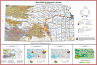
Water Right Development in Kansas Page Size: 54 x 36 inches. Low Resolution : 96 Dots Per Inch (DPI), 12.3 MB JPEG Med. Resolution : 150 Dots Per Inch (DPI), 23.3 MB JPEG High Resolution (PDF): 17.7 MB PDF |
 |
Average Change in Water Table Elevations from 2000 to 2005 for the High Plains Aquifer in Kansas Source: KGS Open File Report 2005-8 Page Size: 42 x 34 inches. Low Resolution : 96 Dots Per Inch (DPI), 4.36 MB JPEG High Resolution (PDF): 1.96 MB PDF |
 |
Average 2003-2005 Saturated Thickness for the High Plains Aquifer in Kansas Source: KGS Open File Report 2005-8 Page Size: 20 x 16 inches. Low Resolution : 96 Dots Per Inch (DPI), 1.69 MB JPEG High Resolution (PDF): 1.75 MB PDF |
 |
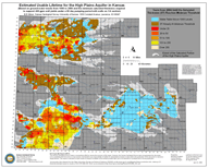
Estimated Usable Lifetime for the High Plains Aquifer in Kansas (based on ground-water trends from 1996 to 2000) Source: KGS Open File Report 2005-8 Page Size: 20 x 16 inches. Low Resolution : 96 Dots Per Inch (DPI), 1.76 MB JPEG High Resolution (PDF): 1.6 MB PDF |
 |
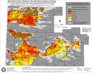
Estimated Usable Lifetime for the High Plains Aquifer in Kansas (based on ground-water trends from 2000 to 2005) Source: KGS Open File Report 2005-8 Page Size: 20 x 16 inches. Low Resolution : 96 Dots Per Inch (DPI), 1.79 MB JPEG High Resolution (PDF): 1.67 MB PDF |
Updated October 17, 2007
Comments to webadmin@kgs.ku.edu
