Kansas Geological Survey, Open-file Report 2019-19
Part of the Ogallala-High Plains Aquifer Project
KGS Open-file Report 2019-19
June 2019

The index well program is directed at developing improved approaches for measuring and interpreting hydrologic responses at the local scale (section to township) in the High Plains aquifer (HPA) in western and south-central Kansas. The program is supported by the Kansas Water Office (KWO) with Water Plan funding as a result of KWO's interest in and responsibility for long-term planning of groundwater resources in western and south-central Kansas. The Kansas Department of Agriculture, Division of Water Resources (DWR), provides assistance, as do Groundwater Management Districts (GMDs) 1, 3, 4, and 5 and the Kansas State University Northwest Research-Extension Center (KSU-NWREC).
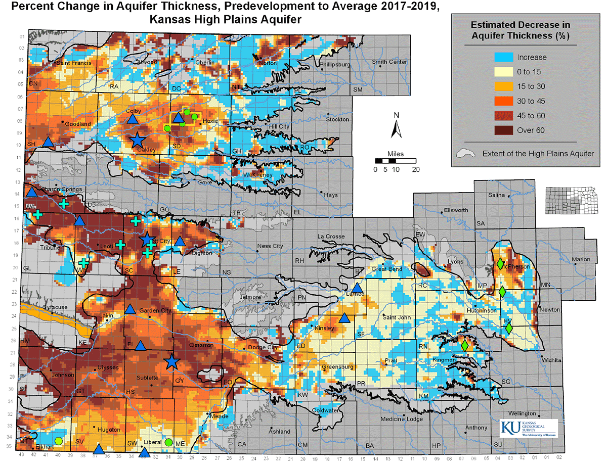
The project began with the installation of three monitoring ("index") wells in western Kansas in late summer 2007. Each well has a transducer for continuous monitoring of water levels that is connected to telemetry equipment to allow real-time viewing of well conditions on a publicly accessible website. Since late 2012, wells have been continuously added to the network. The index well network now consists of 15 wells with telemetry equipment and real-time data access from the KGS website and 8 wells without telemetry equipment (water-level data downloaded approximately quarterly and displayed on the KGS website). The vision of the index well program is that these wells, and other wells that will be added to the network over time, will be monitored for the long term. Shorter-term monitoring will be done at additional wells (expansion wells); seven expansion wells are monitored in GMD1. A major focus of the program is to use these data for the development of criteria or methods to evaluate the effectiveness of management strategies at the local scale in the HPA in western and south-central Kansas. These data are also used to develop a better understanding of the major mechanisms affecting water levels in the Kansas HPA. This improved understanding is then incorporated into the groundwater models of the aquifer.
This report provides a concise description of conditions as of late winter to early spring of 2019. The majority of the report consists of an update and interpretation of the hydrographs for all of the index wells and the GMD1 expansion wells. In addition, a discussion of the relationships among precipitation (as characterized by radar data), annual water-level changes, and nearby water use at the three original index wells and three additional wells, and the implications of those relationships for efforts to moderate water- level declines by pumping reductions are presented.
The major findings of the index well program to date are as follows:
In addition to the concise description in this report, these findings are discussed in previous program reports, a recent KGS publication (Whittemore et al., 2018), and scientific journal articles resulting from program work (Butler et al., 2013; Whittemore et al., 2016; Butler, Whittemore, Wilson, and Bohling, 2016, 2018).
The focus of activities in 2019 will be on the continuation of monitoring at all program wells; continued analysis of hydrographs from all wells; installation of equipment for real-time monitoring at four existing wells in GMD2; exploring the possibility of adding additional wells to the network; and further assessment of the relationships among radar precipitation data, annual water-level change, and water use.
Read the PDF version (16.2 MB)
Kansas Geological Survey, Geohydrology
Placed online July 12, 2019
Comments to webadmin@kgs.ku.edu
The URL for this page is http://www.kgs.ku.edu/Geophysics/OFR/2019/OFR19_19/index.html