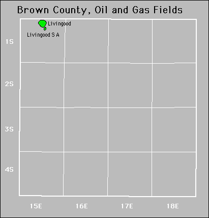
| Year | Oil | Gas | ||||
|---|---|---|---|---|---|---|
| Production (bbls) |
Wells | Cumulative (bbls) |
Production (mcf) |
Wells | Cumulative (mcf) |
|
| 1995 | 173 | 1 | 205,880 | - | - | 0 |
| 1996 | 477 | 4 | 206,357 | - | - | 0 |
| 1997 | - | - | 206,357 | - | - | 0 |
| 1998 | - | - | 206,357 | - | - | 0 |
| 1999 | - | - | 206,357 | - | - | 0 |
| 2000 | - | - | 206,357 | - | - | 0 |
| 2001 | - | - | 206,357 | - | - | 0 |
| 2002 | - | - | 206,357 | - | - | 0 |
| 2003 | - | - | 206,357 | - | - | 0 |
| 2004 | - | - | 206,357 | - | - | 0 |
| 2005 | - | - | 206,357 | - | - | 0 |
| 2006 | - | - | 206,357 | - | - | 0 |
| 2007 | - | - | 206,357 | - | - | 0 |
| 2008 | - | - | 206,357 | - | - | 0 |
| 2009 | - | - | 206,357 | - | - | 0 |
| 2010 | - | - | 206,357 | - | - | 0 |
| 2011 | - | - | 206,357 | - | - | 0 |
| 2012 | 92 | 1 | 206,449 | - | - | 0 |
| 2013 | 1,600 | 4 | 208,049 | - | - | 0 |
| 2014 | 16,791 | 6 | 224,840 | - | - | 0 |
| 2015 | 27,160 | 9 | 252,000 | - | - | 0 |
| 2016 | 19,417 | 9 | 271,417 | - | - | 0 |
| 2017 | 13,038 | 8 | 284,455 | - | - | 0 |
| 2018 | 9,368 | 9 | 293,823 | - | - | 0 |
| 2019 | 6,472 | 10 | 300,295 | - | - | 0 |
| 2020 | 6,047 | 9 | 306,342 | - | - | 0 |
| 2021 | 4,404 | 9 | 310,746 | - | - | 0 |
| 2022 | 4,210 | 8 | 314,956 | - | - | 0 |
| 2023 | 3,449 | 7 | 318,405 | - | - | 0 |
| 2024 | 2,541 | 6 | 320,946 | - | - | 0 |


Active
Forest City Coal Gas Area
Livingood
Livingood South
No Abandoned fields.