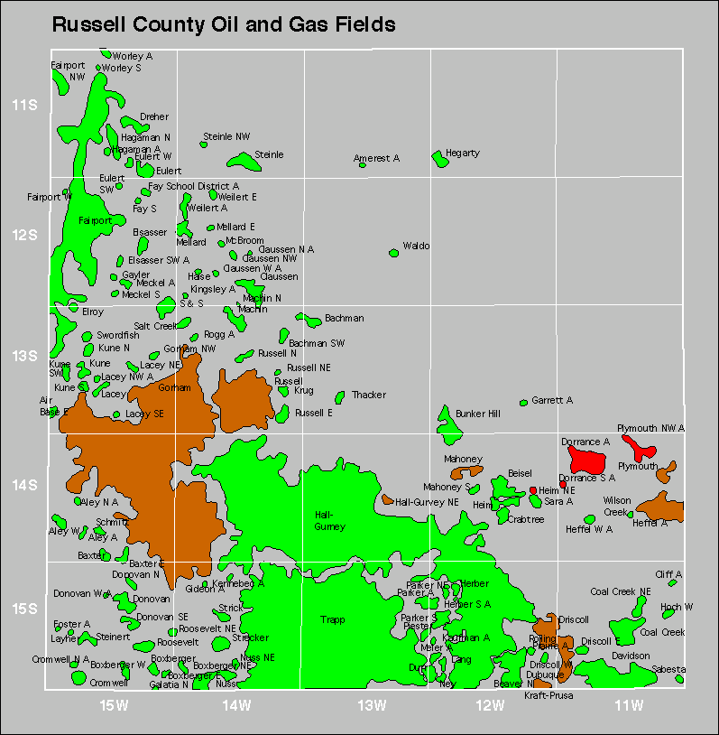
| Year | Oil | Gas | ||||
|---|---|---|---|---|---|---|
| Production (bbls) |
Wells | Cumulative (bbls) |
Production (mcf) |
Wells | Cumulative (mcf) |
|
| 1995 | 2,610,895 | 2738 | 497,677,787 | - | - | 1,909,267 |
| 1996 | 2,551,812 | 2171 | 500,229,599 | - | - | 1,909,267 |
| 1997 | 2,284,978 | 2103 | 502,514,577 | - | - | 1,909,267 |
| 1998 | 2,020,602 | 1950 | 504,535,179 | - | - | 1,909,267 |
| 1999 | 1,900,377 | 1811 | 506,435,556 | - | - | 1,909,267 |
| 2000 | 1,863,481 | 1769 | 508,299,037 | - | - | 1,909,267 |
| 2001 | 1,797,940 | 1741 | 510,096,977 | - | - | 1,909,267 |
| 2002 | 1,731,915 | 1754 | 511,828,892 | - | - | 1,909,267 |
| 2003 | 1,705,815 | 1731 | 513,534,707 | - | - | 1,909,267 |
| 2004 | 1,705,175 | 1763 | 515,239,882 | - | - | 1,909,267 |
| 2005 | 1,717,564 | 1750 | 516,957,446 | - | - | 1,909,267 |
| 2006 | 1,814,006 | 1805 | 518,771,452 | - | - | 1,909,267 |
| 2007 | 1,801,806 | 1834 | 520,573,258 | - | - | 1,909,267 |
| 2008 | 1,862,965 | 1870 | 522,436,223 | - | - | 1,909,267 |
| 2009 | 1,830,480 | 1878 | 524,266,703 | - | - | 1,909,267 |
| 2010 | 1,830,517 | 1886 | 526,097,220 | - | - | 1,909,267 |
| 2011 | 1,884,396 | 1894 | 527,981,616 | - | - | 1,909,267 |
| 2012 | 2,002,811 | 1933 | 529,984,427 | - | - | 1,909,267 |
| 2013 | 1,937,660 | 1950 | 531,922,087 | - | - | 1,909,267 |
| 2014 | 1,955,950 | 2008 | 533,878,037 | - | - | 1,909,267 |
| 2015 | 1,844,012 | 2037 | 535,722,049 | - | - | 1,909,267 |
| 2016 | 1,620,664 | 1995 | 537,342,713 | - | - | 1,909,267 |
| 2017 | 1,600,018 | 1989 | 538,942,731 | - | - | 1,909,267 |
| 2018 | 1,557,728 | 1998 | 540,500,459 | - | - | 1,909,267 |
| 2019 | 1,499,286 | 1971 | 541,999,745 | - | - | 1,909,267 |
| 2020 | 1,315,450 | 1916 | 543,315,195 | - | - | 1,909,267 |
| 2021 | 1,335,029 | 1866 | 544,650,224 | - | - | 1,909,267 |
| 2022 | 1,334,459 | 1840 | 545,984,683 | - | - | 1,909,267 |
| 2023 | 1,322,857 | 1809 | 547,307,540 | - | - | 1,909,267 |
| 2024 | 1,183,076 | 1787 | 548,490,616 | - | - | 1,909,267 |


| Abandoned | ||
|---|---|---|
| Aley Amerest Claussen North Claussen West Fay School District Foster Garrett |
Haise Heffel Heim Northeast Kingsley Kune Layher Meckel |
Meier Rogg Rolling Prairie Weilert |