


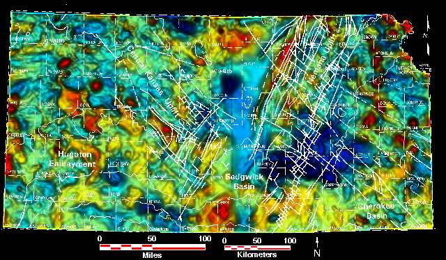
Kansas Geological Survey, Open File Report 96-51
- Color maps, "relief" created by vertical illumination, with overlays of...
- County Lines Only ||
Oil and Gas Fields ||
Post-Mississippian Structure ||
Regional Precambrian Structure
- Top of the Precambrian ||
Regional lineations ||
Local lineations
- Color maps with overlays of...
- County Lines Only ||
Oil and Gas Fields ||
Top of the Precambrian ||
Regional lineations ||
Local lineations
- Black and white maps, "relief" created by vertical illumination,
with overlays of...
- County Lines Only ||
Oil and Gas Fields
- Maps showing...
- Regional lineations, oil and gas fields ||
Local lineations, oil and gas fields
Regional contours of top of Precambrian every 1000 ft. relative to sea level.
Overlay based on
Baars, D.L., and Watney, W.L., 1991, Paleotectonic control of reservoir facies,
in Franseen, E.K., Watney, W.L., Kendall, C.G.Sp.C., and Ross, W. (eds.),
Sedimentary modeling: Kansas Geological Survey, Bulletin 233, p. 253-262.
Kansas Geological Survey, Petroleum Research Section
Updated Dec. 17, 1996
Please send comments to webadmin@kgs.ku.edu
The URL for this page is HTTP://www.kgs.ku.edu/PRS/PotenFld/mag/faults.html