|
|
|
|
Kansas Geological Survey, Open-file Report 2001-14
2000 Digital Petroleum Atlas Annual Report
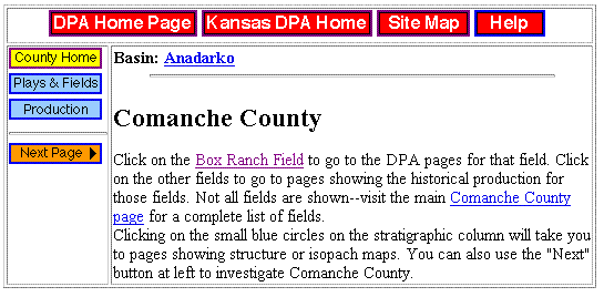

Figure 2. Comanche County, a sample county page added to the Digital Petroleum Atlas in year 4. County page shows structure on top of Meramecian and contains a field study (Box Ranch). Page shows typical navigation buttons and page layout. Map and stratigraphic column are interactive and linked to other county-scale maps and selected field studies. Blue links are active and red horizon is displayed. (http://www.kgs.ku.edu/DPA/County/abc/comanche.html).
| Table of Contents | Previous Page | Figure 1 | Next Page | Figure 3 |