Oil and Gas Maps of Kansas
New maps revised March 2019.
Paper copies of each map are available from the Kansas Geological Survey, 1930 Constant Ave., Lawrence, KS 66047 (or phone 785-864-3965) and at 4150 W. Monroe St., Wichita, KS 67209-2640 (phone 316-943-2343).
The cost is $20 for the statewide map and $10 for each area map plus shipping and handling. Inquire about shipping and handling charges and, for Kansas residents, sales tax.
- PDF version of Map M-121, Statewide Map (Adobe Acrobat file, 5 MB)

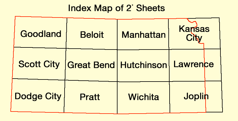
Goodland Quadrangle, Map M121-1
Beloit Quadrangle, Map M121-2
Manhattan Quadrangle, Map M121-3
Kansas City Quadrangle, Map M121-4
Lawrence Quadrangle, Map M121-5
Hutchinson Quadrangle, Map M121-6
Great Bend Quadrangle, Map M121-7
Scott City Quadrangle, Map M121-8
Dodge City Quadrangle, Map M121-9
Pratt Quadrangle, Map M121-10
Wichita Quadrangle, Map M121-11
Joplin Quadrangle, Map M121-12
GIS files of the oil and gas fields are available here. If you are interested in other GIS coverages, please contact the GIS clearinghouse for the State of Kansas: the Data Access and Support Center.